Planning a First Ride on an Unfamiliar Route
Planning a first ride on an unfamiliar route is easier when you choose a modest distance, note the route’s broad shape and leave room to pause or turn back.
How far should you ride when you do not yet know what a route feels like? Planning a first ride on an unfamiliar route is less about predicting every detail than choosing a manageable outing with clear options to pause, shorten or return. A map can show where roads go; it cannot tell you exactly how a bend, climb or busy junction will feel from the saddle.
The case below is invented. It follows one rider making a simple plan, then draws out the decisions that can help you make your own. The aim is not to complete a route at all costs: it is to come home with a better understanding of what suits you.
A modest first outing
Imagine that Sam has recently started cycling on local paths and wants to try a loop beyond familiar streets. A map suggests a route from a village green, along a canal towpath, through a small town and back on quiet lanes. The loop looks appealing, but Sam has not ridden its towpath surface or the lanes outside town.
Sam begins by setting a gentle intention: explore the area and return feeling able to ride again, rather than reach a particular destination by a particular time. That distinction matters. A first ride is partly an outing and partly a chance to learn what the route asks of you. If the surface is rougher than expected or the town feels hectic, changing the plan is part of riding well.
Instead of treating the mapped loop as fixed, Sam looks for a nearby point where turning back would be straightforward. The canal path runs out and back from the green, while the town and lanes form an optional extension. This gives the ride a simple core and an add-on, rather like packing a small bag with room left for what you discover along the way.
Choosing a manageable distance
A manageable distance depends on more than the number shown on a map. Consider the kind of riding you already do, the surface, the climbing, likely stops and how easily you can get home if you tire. A smooth, familiar path may feel very different from an equally long route with loose gravel, repeated junctions or a sustained climb.
For Sam, the useful question is not “What distance should a beginner ride?” but “What is a comfortable outing for me, with this route’s unknowns?” Sam compares the proposed loop with recent rides that felt comfortable and chooses a shorter out-and-back as the main plan. The town loop remains optional rather than a distance Sam must earn.
On a route with a clear return line, the halfway point can be a natural decision moment. On a circular route, look for places where you can leave the planned line without creating a confusing detour. A shorter option is only useful if you can identify it before you are tired, so mark it on the map rather than relying on memory.
Do not let a route planner’s estimate stand in for your own judgement. Such estimates cannot fully account for your pace, stops, weather, surface or comfort in traffic. If you are uncertain, choose less distance and preserve the option to add more after the opening part feels manageable.
Reading the route’s shape
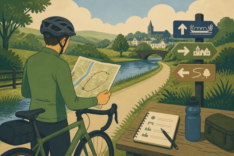
Sam studies the map at two levels. First comes the broad shape: start at the village green, follow the canal west, and return along the same path. The second level is a handful of decision points: the towpath entrance, a bridge where the path changes side, and the point where the optional town loop begins.
This is enough to make the route legible without trying to memorise every turn. Notice whether the route is an out-and-back, a loop or a line that depends on transport at the far end. Check where roads meet paths, where a bridge or gate may alter your direction, and whether a shorter return follows the same way you came.
Look at the route’s broad demands as well as its shape. A map’s contour lines or elevation view can signal a climb, but a small hill may feel different on a loaded bike or after a long ride. Street and path maps can also be incomplete or out of date. Use them to form a plan, then allow for signs, closures and conditions on the day.
Sam saves the route on a phone and writes down the three decision points in a pocket notebook. The phone is useful for checking position, but Sam does not expect to keep looking at it while riding. A glance at a screen near a safe stopping place is less distracting than trying to interpret a junction while moving.
Leaving room for change
A plan needs space for the ride to differ from the map. Sam chooses a stopping place at the bridge and another at the edge of town, where it is possible to pause without blocking the path. Those stops are not signs of failure; they give Sam time to check directions, notice how the bike and body feel, and decide whether to continue.
Sam also decides in advance what might prompt a shorter ride: feeling unusually tired, losing confidence on the surface, finding a closure, or reaching a busier road than expected. These are not rules for every cyclist. They are personal signals that make it easier to change course without turning the decision into a test of willpower.
Before leaving, Sam checks the weather and daylight forecast, carries water and a charged phone, and tells a friend the intended area and approximate return plan. The details depend on the outing and local conditions, but the principle is simple: bring what supports a calm ride, not equipment for an imagined expedition.
Route access and transport options can depend on local signs, land access, service information and the instructions supplied with equipment or apps. Check the relevant information before setting out, and do not assume a mapped path is open to bicycles simply because it appears on a screen.
Questions before setting out?
How do I choose a first-ride distance?
Start from rides that already feel comfortable, then allow for the unfamiliar surface, climbing, junctions and stops on the new route. If you are unsure, make the shorter version your main plan and treat any extra distance as optional.
Should I choose a loop or an out-and-back?
An out-and-back can be easier to shorten because you already know the way back, while a loop may offer more variety but require more navigation. Choose the shape that makes the return plan clearest for your confidence and the route available.
What should I note on a route map?
Mark the start, the broad direction, distinctive junctions or crossings, likely stopping places and any point where you can shorten the ride. Keep the notes brief enough to recall without studying a screen at every turn.
When should I turn back?
Turn back or pause when the route feels beyond your comfort, conditions change, or you are unsure how to proceed safely. You do not need to reach the planned endpoint to make the ride worthwhile.
What Sam learns
On the day, Sam follows the canal to the bridge, stops to check the map and notices that the towpath is rougher than expected. The ride still feels comfortable, but the optional town loop now seems less appealing. Sam turns around rather than adding an unfamiliar road section simply because it was drawn on the original route.
Back at the green, Sam has gained specific information: the canal path is pleasant but uneven in places, the bridge is an easy landmark, and the shorter out-and-back suited the day. The outcome is not a completed loop; it is a useful basis for deciding what to try next time. Sam can return to the canal, explore the town separately or choose another route with a clearer surface.
The planning lesson is to make the first version of an unfamiliar ride easy to revise. Choose a distance from your own recent experience, understand the route’s broad shape, identify a few decision points and leave time for a pause or early return. Planning a first ride on an unfamiliar route works best when the map guides your choices without making them for you.